


View forecast
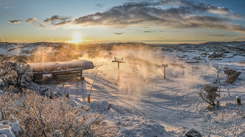
Perisher at 1867 m altitude
Issued by Snow-Forecast.com at: 3 am (local time) / 19 May 2024
Now
Sunday 19 | Monday 20 | Tuesday 21 | Wednesday 22 | Thursday 23 | Friday 24 | Saturday 25 | |||||||||||||||
AM | PM | night | AM | PM | night | AM | PM | night | AM | PM | night | AM | PM | night | AM | PM | night | AM | PM | night | |
some clouds | some clouds | clear | clear | clear | some clouds | clear | clear | clear | clear | clear | clear | clear | clear | some clouds | some clouds | cloudy | some clouds | some clouds | some clouds | some clouds | |
km/h | |||||||||||||||||||||
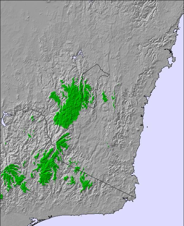
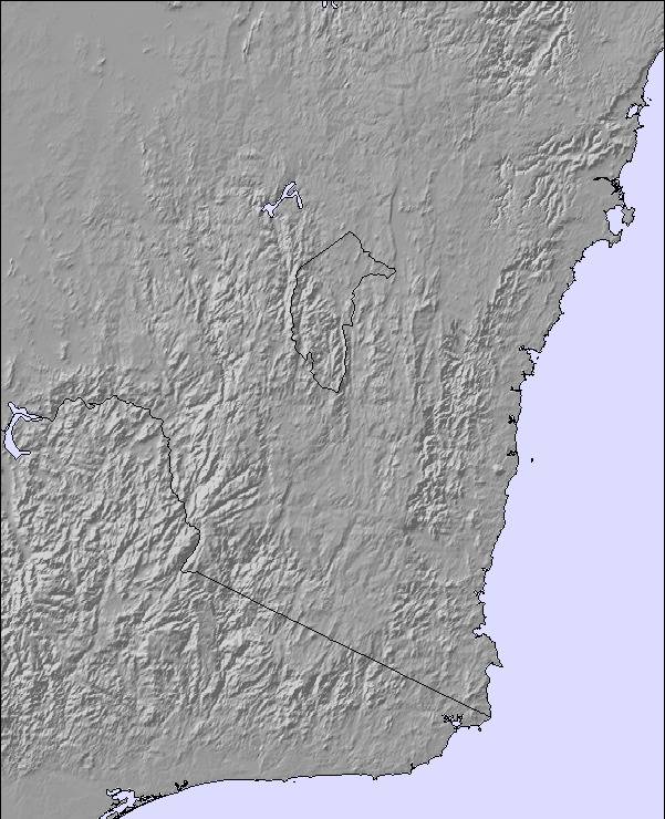
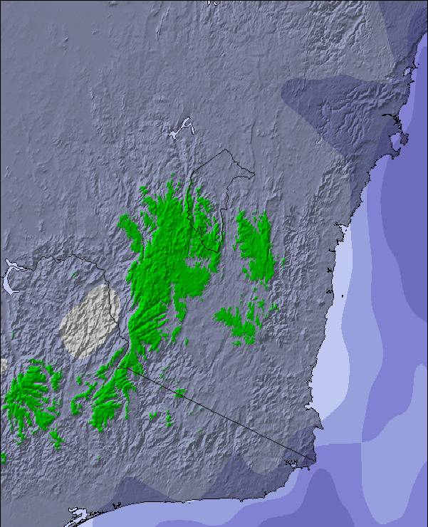
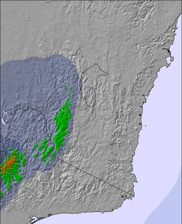
Snow map | 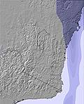 | 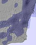 | 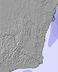 | 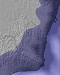 | 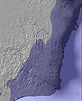 | 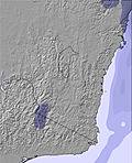 | 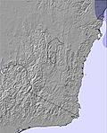 | ||||||||||||||
— | — | — | — | — | — | — | — | — | — | — | — | — | — | — | — | — | — | — | — | — | |
— | — | — | — | — | — | — | — | — | — | — | — | — | — | — | — | — | — | — | — | — | |
max°C | 2 | 3 | 1 | 4 | 4 | 1 | 4 | 4 | 1 | 4 | 4 | 3 | 6 | 6 | 3 | 5 | 3 | 2 | 5 | 4 | 2 |
min°C | 2 | 2 | 0 | 1 | 2 | 1 | 2 | 2 | 1 | 2 | 2 | 2 | 4 | 3 | 2 | 3 | 2 | 2 | 3 | 3 | 2 |
-2 | -2 | -2 | -2 | 0 | -1 | 2 | 1 | 1 | 0 | 0 | 0 | 2 | 1 | -1 | 2 | 2 | 2 | 3 | 3 | 2 | |
39 | 52 | 61 | 58 | 52 | 68 | 54 | 52 | 69 | 56 | 60 | 65 | 56 | 52 | 68 | 70 | 74 | 75 | 71 | 64 | 73 | |
2200 | 2350 | 2900 | 2500 | 2800 | 2700 | 2550 | 2500 | 2050 | 2250 | 2450 | 2550 | 2950 | 3100 | 3000 | 2750 | 2750 | 2650 | 2700 | 2600 | 2300 | |
6:58 | — | — | 7:00 | — | — | 7:01 | — | — | 7:01 | — | — | 7:01 | — | — | 7:03 | — | — | 7:03 | — | — | |
— | 5:05 | — | — | 5:04 | — | — | 5:04 | — | — | 5:02 | — | — | 5:02 | — | — | 5:01 | — | — | 5:01 | — | |
Next 0-3 days weather summary:
Mostly dry. Freeze-thaw conditions (max 4°C on Mon morning, min 0°C on Sun night). Wind will be generally light.
Next 4-6 days weather summary:
Mostly dry. Mild temperatures (max 6°C on Thu morning, min 2°C on Wed morning). Wind will be generally light.
Popular Perisher Pages
Snow Radar
Submit a reportLatest snow reports near Perisher:
- 8 hours ago

Rain reported from Perisher Valley Aws at 1738 metres elevation one km SSW of Perisher but it is forecast cold enough for snow at the ski area from Perisher
15 km away from Perisher
18 hours agoContinuous light snow reported from Thredbo Village at 421 metres elevation WNW of Thredbo Ski Resort from Thredbo
- 18 hours ago

Snowing at a moderate rate in Perisher. from Perisher
Perisher Snow Conditions
| Top snow depth: | 0 cm |
|---|---|
| Bottom snow depth: | 0 cm |
| Fresh snowfall depth: | 2 cm |
| Last snowfall: | 17 May 2024 |
| Snow Alerts | Create Alert |
Other resorts in Australia - New South Wales are reporting: powder (0) / good piste (0)
Snow-Forecast Partner Offers
Show your business here
Snow History
Week 3 of May has on average:
0.1 | Bluebird Powder days Fresh snow, mostly sunny, light wind. |
|---|---|
0.1 | Powder days Fresh snow, limited sun, any wind. |
0.2 | Bluebird days Average snow, mostly sunny, light wind. |

Perisher Forecast Snowfall
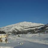
Perisher Resort Webcam
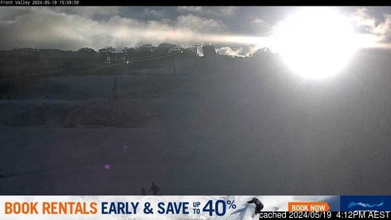
- 2pm yesterday

- 2 days ago

- 3 days ago

- 4 days ago

- 5 days ago

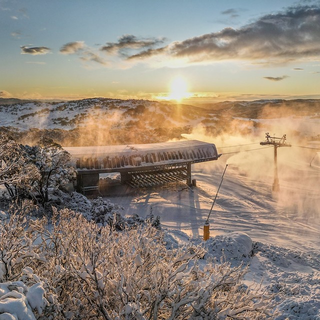
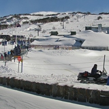
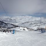
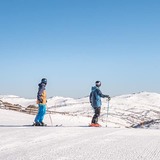
Photos of Perisher
Other resorts in Australia - New South Wales are reporting: powder (0) / good piste (0)
The above table gives the weather forecast for Perisher at the specific elevation of 1867 m. Our sophisticated weather models allow us to provide snow forecasts for the top, middle and bottom ski stations of Perisher. To access the weather forecasts for the other elevations, use the tab navigation above the table. For a wider view of the weather, check out the Weather Map of Australia.
Click here to read further information on freezing levels and how we forecast our temperatures.
Visitor Reviews of Perisher
Overall 3.3 Based on 31 votes and 50 reviews
- Snowsure
- Variety of pistes
- Vote
- Chris Czarnik from Australia writes:
I am now 79 and going to ski Perisher for 2 weeks. I started ⛷️ skiing in Perisher in around 1970 and remember a day ticket $6.00. The ticket person would use a different colour permanent marker to write a date on the ticket. You had to attach it permanently to your outer garment. Those were the days never to be forgotten. Perisher is a great ski resort, especially after Blue Cow and Guthega were combined. I have been skiing ⛷️ Perisher for 55 years and have no complains. Sure we had good and not so good seasons with the snow. I lived in Canberra, so it was a 2.5 hour drive to get to to Perisher. Only thing was they were a bit slow putting in new lifts. I would give Perisher 9 out of 10. (note from the editor: names of individuals are not included in resort reviews.)
Visitor Reviews of Perisher
Chris Czarnik from Australia writes:
I am now 79 and going to ski Perisher for 2 weeks. I started ⛷️ skiing in Perisher in around 1970 and remember a day ticket $6.00. The ticket person would use a different colour permanent marker to write a date on the ticket.
You had to attach it permanently to your outer garment. Those were the days never to be forgotten. Perisher is a great ski resort, especially after Blue Cow and Guthega were combined. I have been skiing ⛷️ Perisher for 55 years and have no complains. Sure we had good and not so good seasons with the snow.
I lived in Canberra, so it was a 2.5 hour drive to get to to Perisher.
Only thing was they were a bit slow putting in new lifts. I would give Perisher 9 out of 10.
(note from the editor: names of individuals are not included in resort reviews.)
Free Snow-Forecast.com weather widget for your website
The Perisher skiing weather widget is available to embed on external websites free of charge. It provides a daily summary of our Perisher snow forecast and current weather conditions. Simply go to the feed configuration page and follow the 3 simple steps to grab the custom html code snippet and paste it into your own site. You can choose the snow forecast elevation (summit, mid-mountain or bottom lift) and metric/imperial units for the snow forecast feed to suit your own website…. Click here to get the code.
View detailed snow forecast for Perisher at:
snow-forecast.com

 Nearest