
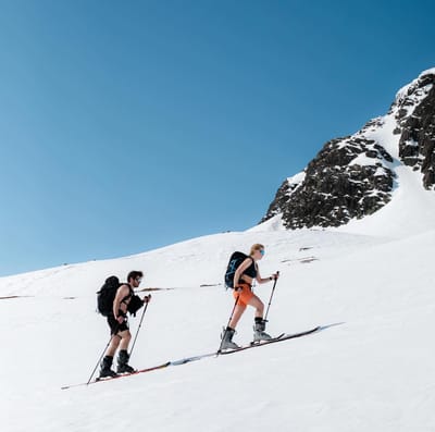
Ski Hire by Intersport
Click here for discount


Pitztal Glacier Weather (Next 3 days): The snow forecast for Pitztal Glacier is: Moderate rain (total 11.0mm), heaviest on Tue afternoon giving way to a moderate fall of snow, heaviest on Tue night. Freeze-thaw conditions (max 5°C on Mon afternoon, min -1°C on Tue night). Wind will be generally light.
Pitztal Glacier Weather (Days 4-6): A light fall of snow, heaviest on Thu night. Turning milder with light rain (total 7.0mm) on Sat afternoon. Freeze-thaw conditions (max 3°C on Sat afternoon, min 0°C on Thu morning). Wind will be generally light.
| Resort | Snow Depth | Temp. (°C) | Wind (km/h) | Weather | ||
|---|---|---|---|---|---|---|
| Top Lift: | -4 | |||||
| Middle Lift: | 3 | |||||
| Bottom Lift: | 10 |
Latest snow reports near Pitztal Glacier:

Monday 20 | Tuesday 21 | Wednesday 22 | Thursday 23 | Friday 24 | Saturday 25 | Sunday 26 | |||||||||||||||
AM | PM | night | AM | PM | night | AM | PM | night | AM | PM | night | AM | PM | night | AM | PM | night | AM | PM | night | |
clear | light rain | light snow | light rain | mod. rain | heavy snow | light snow | light snow | light snow | light snow | light snow | mod. snow | light snow | light snow | light snow | light snow | risk thun- der | rain shwrs | clear | risk thun- der | rain shwrs | |
km/h | |||||||||||||||||||||
Snow map |  |  |  |  |  |  |  | ||||||||||||||
— | — | — | — | — | 10 | — | 1.0 | 1.0 | — | 3 | 6 | 1.0 | 1.0 | 5 | — | — | — | — | — | — | |
— | 2.0 | 1.0 | 2.0 | 6 | — | — | — | — | — | — | — | — | — | — | — | 4 | 3 | — | 7 | 11 | |
max°C | 3 | 5 | 4 | 3 | 3 | 0 | 0 | 1 | 1 | 0 | 2 | 0 | 0 | 1 | 1 | 1 | 3 | 3 | 5 | 6 | 6 |
min°C | 2 | 5 | 2 | 2 | 2 | -1 | -1 | 1 | 0 | 0 | 1 | 0 | 0 | 1 | 0 | 0 | 2 | 2 | 4 | 6 | 4 |
2 | 4 | 0 | 0 | 2 | -4 | -4 | -1 | -2 | 0 | 1 | 0 | -2 | 0 | 0 | 0 | 2 | 2 | 4 | 6 | 4 | |
82 | 69 | 82 | 97 | 99 | 97 | 92 | 94 | 88 | 91 | 99 | 97 | 97 | 95 | 97 | 92 | 88 | 76 | 73 | 74 | 79 | |
2900 | 3250 | 3100 | 2950 | 2950 | 2350 | 2550 | 2750 | 2600 | 2650 | 2800 | 2600 | 2600 | 2800 | 2600 | 2700 | 3000 | 3100 | 3250 | 3400 | 3350 | |
5:35 | — | — | 5:33 | — | — | 5:33 | — | — | 5:31 | — | — | 5:31 | — | — | 5:30 | — | — | 5:28 | — | — | |
— | — | 8:51 | — | — | 8:52 | — | — | 8:52 | — | — | 8:54 | — | — | 8:55 | — | — | 8:57 | — | — | 8:58 | |
Moderate rain (total 11.0mm), heaviest on Tue afternoon giving way to a moderate fall of snow, heaviest on Tue night. Freeze-thaw conditions (max 5°C on Mon afternoon, min -1°C on Tue night). Wind will be generally light.
A light fall of snow, heaviest on Thu night. Turning milder with light rain (total 7.0mm) on Sat afternoon. Freeze-thaw conditions (max 3°C on Sat afternoon, min 0°C on Thu morning). Wind will be generally light.
Latest snow reports near Pitztal Glacier:
| Top snow depth: | — |
|---|---|
| Bottom snow depth: | — |
| Fresh snowfall depth: | 7 cm |
| Last snowfall: | 18 May 2024 |
| Snow Alerts | Create Alert |
0.8 | Bluebird Powder days Fresh snow, mostly sunny, light wind. |
|---|---|
1.6 | Powder days Fresh snow, limited sun, any wind. |
0.1 | Bluebird days Average snow, mostly sunny, light wind. |
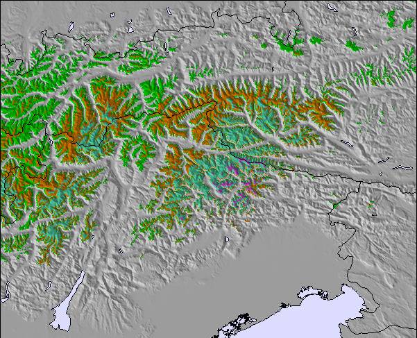
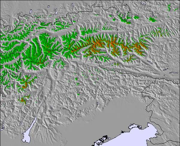
The above table gives the weather forecast for Pitztal Glacier at the specific elevation of 2590 m. Our sophisticated weather models allow us to provide snow forecasts for the top, middle and bottom ski stations of Pitztal Glacier. To access the weather forecasts for the other elevations, use the tab navigation above the table. For a wider view of the weather, check out the Weather Map of Austria.
Click here to read further information on freezing levels and how we forecast our temperatures.
Overall 4.4 Based on 9 votes and 3 reviews
Had a great time skiing in Pitztal in January 2013. I would recommend it for advanced skiers, as the red-only runs from 3440m are pretty challenging. As the previous reviews pointed out, besides the great skiing, new lifts and amazing scenery, there are basically no crowds - we had absolutely no queues during the entire trip, and the slopes stayed in good shape throughout the day. We enjoyed skiing from the 3440m lift during the first part of the day, as the slopes there are steeper and have more sun during the morning. After lunch, we moved to the other side of the resort, to the 3270m lift, which received more sun in the afternoon, had a fun snow park and easier slopes. The retreat from the resort can be made by cable car; if the avalanche risk is low and there are at least 40-50 minutes of daylight left, you can take the "emergency retreat" to the valley, which crosses the glacier and winds through a wild and huge alpine valley. Watch out though, as avalanches there DO happen, and the path is NOT protected. It's worth paying the extra 10 euro a week for the ski pass to include Hochzeiger ski area, as a backup for stormy days, or simply as a variation. It has about 50km of slopes and great views all around. I would recommend the slopes 10 red and 12 black - the first has a great view, the second is long, challenging and fun. On Thursday nights the 6km sled track is lit until 1.30 in the morning. We had a great time in Pitztal and actually prefer it to larger resorts such as Solden and Zillertal due to the lack of crowds and great skiing. If you are a beginner though, there are better choices out there.
Iancu from Romania writes:
Had a great time skiing in Pitztal in January 2013. I would recommend it for advanced skiers, as the red-only runs from 3440m are pretty challenging.
As the previous reviews pointed out, besides the great skiing, new lifts and amazing scenery, there are basically no crowds - we had absolutely no queues during the entire trip, and the slopes stayed in good shape throughout the day. We enjoyed skiing from the 3440m lift during the first part of the day, as the slopes there are steeper and have more sun during the morning. After lunch, we moved to the other side of the resort, to the 3270m lift, which received more sun in the afternoon, had a fun snow park and easier slopes.
The retreat from the resort can be made by cable car; if the avalanche risk is low and there are at least 40-50 minutes of daylight left, you can take the "emergency retreat" to the valley, which crosses the glacier and winds through a wild and huge alpine valley. Watch out though, as avalanches there DO happen, and the path is NOT protected.
It's worth paying the extra 10 euro a week for the ski pass to include Hochzeiger ski area, as a backup for stormy days, or simply as a variation. It has about 50km of slopes and great views all around. I would recommend the slopes 10 red and 12 black - the first has a great view, the second is long, challenging and fun. On Thursday nights the 6km sled track is lit until 1.30 in the morning.
We had a great time in Pitztal and actually prefer it to larger resorts such as Solden and Zillertal due to the lack of crowds and great skiing. If you are a beginner though, there are better choices out there.
The Pitztal Glacier skiing weather widget is available to embed on external websites free of charge. It provides a daily summary of our Pitztal Glacier snow forecast and current weather conditions. Simply go to the feed configuration page and follow the 3 simple steps to grab the custom html code snippet and paste it into your own site. You can choose the snow forecast elevation (summit, mid-mountain or bottom lift) and metric/imperial units for the snow forecast feed to suit your own website…. Click here to get the code.
View detailed snow forecast for Pitztal Glacier at:
snow-forecast.com


 Nearest