


View forecast
Hlíðarfjall Akureyri at 710 m altitude
Issued by Snow-Forecast.com at: 5 am (local time) / 20 May 2024
Now
Monday 20 | Tuesday 21 | Wednesday 22 | Thursday 23 | Friday 24 | Saturday 25 | Sunday 26 | |||||||||||||||
AM | PM | night | AM | PM | night | AM | PM | night | AM | PM | night | AM | PM | night | AM | PM | night | AM | PM | night | |
light snow | light rain | light snow | cloudy | light snow | some clouds | some clouds | rain shwrs | snow shwrs | some clouds | some clouds | cloudy | cloudy | some clouds | cloudy | cloudy | light rain | light rain | light rain | light rain | mod. rain | |
km/h | |||||||||||||||||||||
Snow map |  |  |  | 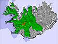 | 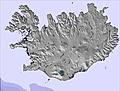 | 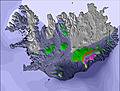 | 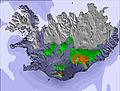 | ||||||||||||||
— | — | — | — | — | — | — | — | — | — | — | — | — | — | — | — | — | — | — | — | — | |
1.0 | 2.0 | — | — | — | — | — | 1.0 | — | — | — | — | — | — | — | — | 1.0 | 2.0 | 1.0 | 5 | 6 | |
max°C | 2 | 3 | 2 | 1 | 2 | 1 | 1 | 3 | 1 | 2 | 4 | 4 | 5 | 8 | 7 | 9 | 9 | 8 | 9 | 9 | 7 |
min°C | 1 | 2 | 1 | 1 | 2 | 0 | 0 | 3 | -1 | 0 | 4 | 4 | 5 | 7 | 6 | 7 | 8 | 8 | 8 | 6 | 6 |
-4 | -2 | -1 | 0 | 0 | -2 | -2 | 0 | -5 | -4 | 0 | -1 | -1 | 2 | 1 | 3 | 5 | 5 | 6 | 4 | 4 | |
97 | 99 | 98 | 91 | 84 | 75 | 72 | 64 | 82 | 73 | 52 | 84 | 85 | 63 | 78 | 73 | 70 | 76 | 77 | 73 | 89 | |
1200 | 1250 | 950 | 850 | 900 | 750 | 750 | 1050 | 650 | 750 | 1100 | 1350 | 1350 | 1800 | 2600 | 2700 | 2700 | 2200 | 1950 | 1900 | 1650 | |
3:16 | — | — | 3:14 | — | — | 3:10 | — | — | 3:05 | — | — | 3:01 | — | — | 2:58 | — | — | 2:55 | — | — | |
— | — | 11:04 | — | — | 11:07 | — | — | 11:12 | — | — | 11:15 | — | — | 11:20 | — | — | 11:23 | — | — | 11:28 | |
Next 0-3 days weather summary:
Light rain (total 4.0mm), mostly falling on Mon morning. Freeze-thaw conditions (max 3°C on Mon afternoon, min -1°C on Wed night). Wind will be generally light.
Next 4-6 days weather summary:
Light rain (total 3.0mm), mostly falling on Sat afternoon. Freeze-thaw conditions (max 9°C on Sat morning, min 0°C on Thu morning). Winds decreasing (strong winds from the SSW on Fri morning, light winds from the S by Sat night).
Popular Hlíðarfjall Akureyri Pages
Snow Radar
Submit a reportLatest snow reports near Hlíðarfjall Akureyri:
- 8 hours ago

Light rain reported from Akureyri Airport at 211 metres elevation 6 kms ENE of Hlíðarfjall Akureyri but it is forecast cold enough for snow at higher elevations in the ski area from Hlíðarfjall Akureyri
- 11 hours ago
Light rain reported from Akureyri Airport at 211 metres elevation 6 kms ENE of Hlíðarfjall Akureyri but it is forecast cold enough for snow at the ski area from Hlíðarfjall Akureyri
- 16 hours ago
Drizzle reported from Akureyri Airport at 211 metres elevation 6 kms ENE of Hlíðarfjall Akureyri but it is forecast cold enough for snow at the ski area from Hlíðarfjall Akureyri
Hlíðarfjall Akureyri Snow Conditions
| Top snow depth: | — |
|---|---|
| Bottom snow depth: | — |
| Fresh snowfall depth: | 6 cm |
| Last snowfall: | 19 May 2024 |
| Snow Alerts | Create Alert |
Other resorts in Iceland are reporting: powder (0) / good piste (0)
Snow-Forecast Partner Offers
Show your business here
Snow History
Week 3 of May has on average:
0.1 | Bluebird Powder days Fresh snow, mostly sunny, light wind. |
|---|---|
0.6 | Powder days Fresh snow, limited sun, any wind. |
0.6 | Bluebird days Average snow, mostly sunny, light wind. |
Hlíðarfjall Akureyri Forecast Snowfall
Photos of Hlíðarfjall Akureyri
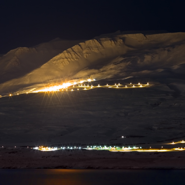
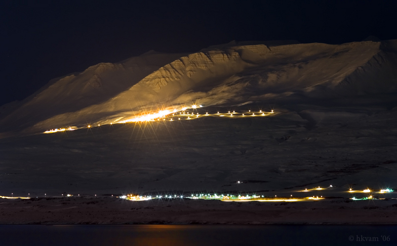
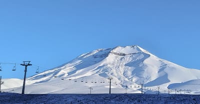
The ski slopes at Mt Hlidarfjall in Eyjafjordur, N-Iceland. by snowfore1
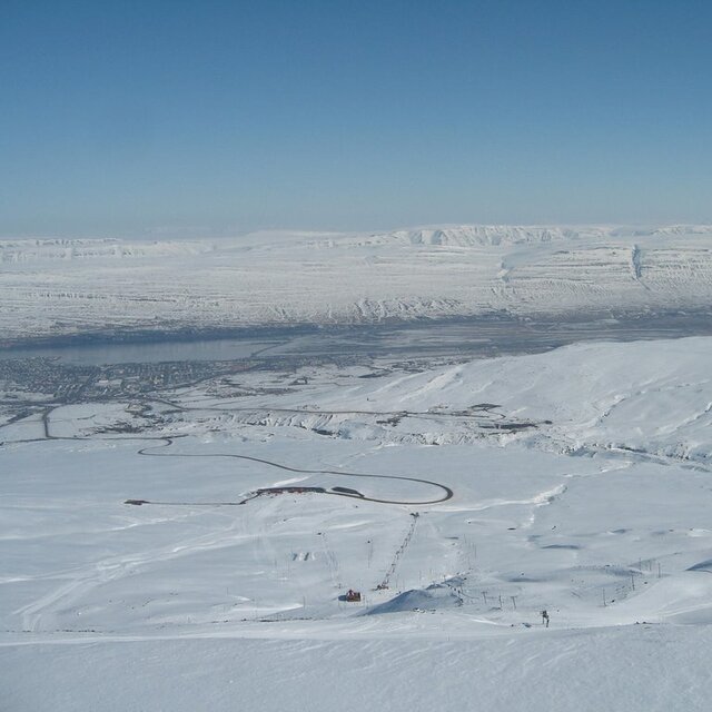
On the top of Akureyri ski area by Gudmundur Karl Jonsson
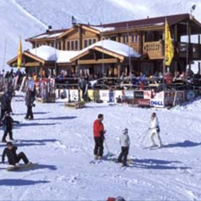
Mid mountain lodge, Strýta by Gudmundur Karl Jonsson
Other resorts in Iceland are reporting: powder (0) / good piste (0)
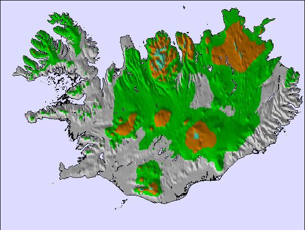
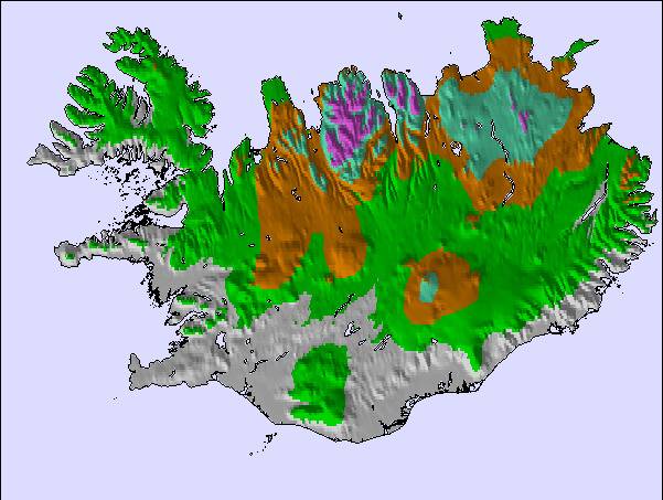
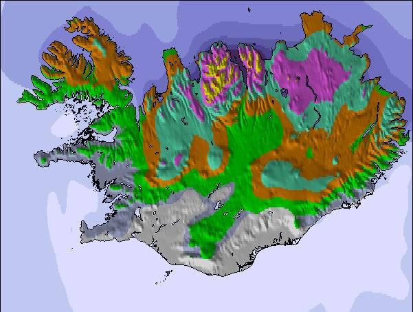
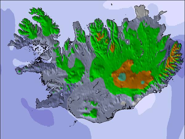
The above table gives the weather forecast for Hlíðarfjall Akureyri at the specific elevation of 710 m. Our sophisticated weather models allow us to provide snow forecasts for the top, middle and bottom ski stations of Hlíðarfjall Akureyri. To access the weather forecasts for the other elevations, use the tab navigation above the table. For a wider view of the weather, check out the Weather Map of Iceland.
Click here to read further information on freezing levels and how we forecast our temperatures.
Resort name is also written as Hlidarfjall Akureyri.
Visitor Reviews of Hlíðarfjall Akureyri
Overall 3.7 Based on 2 votes and 2 reviews
- Snowsure
- Variety of pistes
- Vote
- Steven Koch from Afghanistan writes:
Akureyri is definitively Iceland's best ski resort that although not huge, has some really good slack country and steeps that can be hiked to. Akureyri is also very close to world class ski touring terrain on the Troll Peninsula in the north and the Hidden land to the north east, where folks can enjoy touring as well as awesome heli skiing.
Visitor Reviews of Hlíðarfjall Akureyri
Steven Koch from Afghanistan writes:
Akureyri is definitively Iceland's best ski resort that although not huge, has some really good slack country and steeps that can be hiked to. Akureyri is also very close to world class ski touring terrain on the Troll Peninsula in the north and the Hidden land to the north east, where folks can enjoy touring as well as awesome heli skiing.
Read 1 more reviews of Hlíðarfjall Akureyri or submit your own
Free Snow-Forecast.com weather widget for your website
The Hlíðarfjall Akureyri skiing weather widget is available to embed on external websites free of charge. It provides a daily summary of our Hlíðarfjall Akureyri snow forecast and current weather conditions. Simply go to the feed configuration page and follow the 3 simple steps to grab the custom html code snippet and paste it into your own site. You can choose the snow forecast elevation (summit, mid-mountain or bottom lift) and metric/imperial units for the snow forecast feed to suit your own website…. Click here to get the code.
View detailed snow forecast for Hlíðarfjall Akureyri at:
snow-forecast.com

 Nearest