
Ski Lessons by SkiBro
BOOK NOW
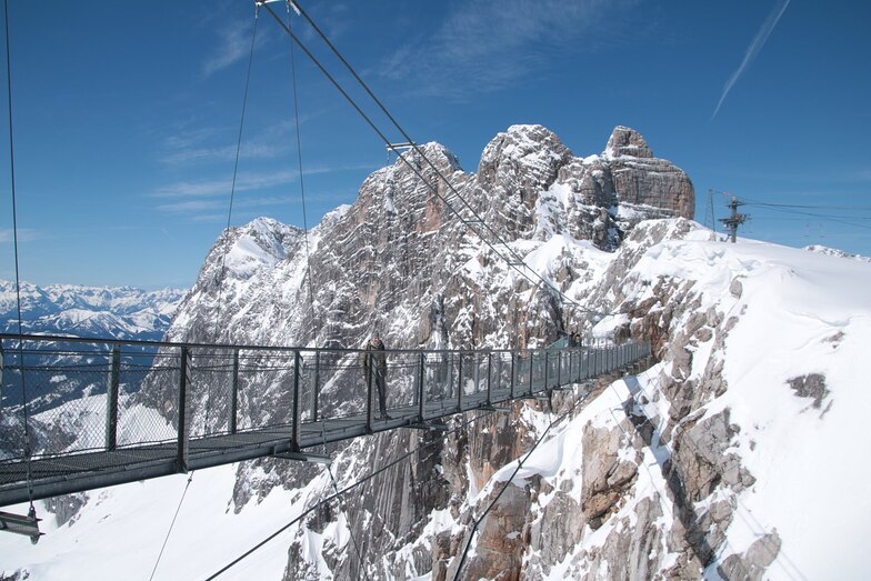
Ski lessons in Dachstein Glacier
Book now


Dachstein Glacier Weather (Next 3 days): The snow forecast for Dachstein Glacier is: A dusting of snow giving way to moderate rain (total 10.0mm) heaviest on Sun night. Freeze-thaw conditions (max 4°C on Mon afternoon, min -1°C on Sat morning). Wind will be generally light.
Dachstein Glacier Weather (Days 4-6): A dusting of snow turning to light rain (total 9.0mm) on Thu afternoon. Freeze-thaw conditions (max 4°C on Tue morning, min -1°C on Wed morning). Winds decreasing (fresh winds from the SSE on Tue afternoon, calm by Tue night).
| Resort | Snow Depth | Temp. (°C) | Wind (km/h) | Weather | ||
|---|---|---|---|---|---|---|
| Top Lift: | -2 | |||||
| Middle Lift: | 2 | |||||
| Bottom Lift: | 5 |
Latest snow reports near Dachstein Glacier:

Saturday 18 | Sunday 19 | Monday 20 | Tuesday 21 | Wednesday 22 | Thursday 23 | Friday 24 | |||||||||||||||
AM | PM | night | AM | PM | night | AM | PM | night | AM | PM | night | AM | PM | night | AM | PM | night | AM | PM | night | |
clear | snow shwrs | light snow | clear | light snow | light snow | rain shwrs | risk thun- der | rain shwrs | some clouds | light rain | light snow | light snow | light snow | snow shwrs | some clouds | risk thun- der | rain shwrs | some clouds | light snow | mod. snow | |
km/h | |||||||||||||||||||||
Snow map |  |  |  |  |  |  |  | ||||||||||||||
— | — | — | — | — | — | — | — | — | — | — | 2.0 | 2.0 | — | — | — | — | — | — | 2.0 | 6 | |
— | — | — | — | 3 | 4 | 1.0 | 1.0 | 1.0 | — | 2.0 | 2.0 | — | — | — | — | 3 | 2.0 | — | — | — | |
max°C | 0 | 1 | 1 | 1 | 2 | 2 | 2 | 4 | 4 | 4 | 4 | 3 | -1 | 1 | 1 | 2 | 4 | 3 | 0 | 1 | 0 |
min°C | -1 | 1 | -1 | 0 | 2 | 1 | 1 | 4 | 3 | 4 | 4 | 0 | -1 | 0 | 0 | 1 | 3 | 1 | 0 | 0 | -1 |
-4 | -1 | -4 | -2 | -1 | -1 | -1 | 2 | 0 | -1 | -2 | 0 | -4 | -2 | 0 | -2 | 0 | -1 | -2 | -5 | -4 | |
63 | 85 | 95 | 83 | 85 | 79 | 74 | 81 | 65 | 88 | 93 | 100 | 97 | 83 | 90 | 85 | 83 | 70 | 93 | 98 | 99 | |
2750 | 2850 | 2600 | 2800 | 3000 | 3000 | 2950 | 3200 | 3250 | 3300 | 3300 | 3000 | 2550 | 2800 | 2700 | 2900 | 3150 | 3100 | 2650 | 2800 | 2500 | |
5:24 | — | — | 5:22 | — | — | 5:22 | — | — | 5:20 | — | — | 5:20 | — | — | 5:18 | — | — | 5:18 | — | — | |
— | — | 8:38 | — | — | 8:39 | — | — | 8:42 | — | — | 8:43 | — | — | 8:44 | — | — | 8:45 | — | — | 8:45 | |
A dusting of snow giving way to moderate rain (total 10.0mm) heaviest on Sun night. Freeze-thaw conditions (max 4°C on Mon afternoon, min -1°C on Sat morning). Wind will be generally light.
A dusting of snow turning to light rain (total 9.0mm) on Thu afternoon. Freeze-thaw conditions (max 4°C on Tue morning, min -1°C on Wed morning). Winds decreasing (fresh winds from the SSE on Tue afternoon, calm by Tue night).
Latest snow reports near Dachstein Glacier:
| Top snow depth: | — |
|---|---|
| Bottom snow depth: | — |
| Fresh snowfall depth: | — |
| Last snowfall: | 8 May 2024 |
| Snow Alerts | Create Alert |
0.2 | Bluebird Powder days Fresh snow, mostly sunny, light wind. |
|---|---|
0.8 | Powder days Fresh snow, limited sun, any wind. |
0.7 | Bluebird days Average snow, mostly sunny, light wind. |
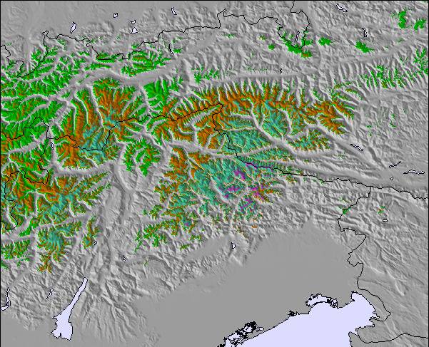
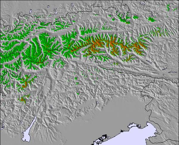
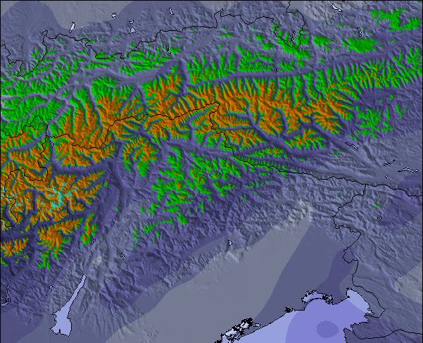
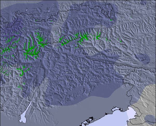
The above table gives the weather forecast for Dachstein Glacier at the specific elevation of 2701 m. Our sophisticated weather models allow us to provide snow forecasts for the top, middle and bottom ski stations of Dachstein Glacier. To access the weather forecasts for the other elevations, use the tab navigation above the table. For a wider view of the weather, check out the Weather Map of Austria.
Click here to read further information on freezing levels and how we forecast our temperatures.
The Dachstein Glacier skiing weather widget is available to embed on external websites free of charge. It provides a daily summary of our Dachstein Glacier snow forecast and current weather conditions. Simply go to the feed configuration page and follow the 3 simple steps to grab the custom html code snippet and paste it into your own site. You can choose the snow forecast elevation (summit, mid-mountain or bottom lift) and metric/imperial units for the snow forecast feed to suit your own website…. Click here to get the code.
View detailed snow forecast for Dachstein Glacier at:
snow-forecast.com


 Nearest