


View forecast
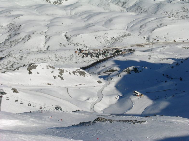
Fuentes de Invierno at 1726 m altitude
Issued by Snow-Forecast.com at: 1 am (local time) / 20 May 2024
Now
Monday 20 | Tuesday 21 | Wednesday 22 | Thursday 23 | Friday 24 | Saturday 25 | Sunday 26 | |||||||||||||||
AM | PM | night | AM | PM | night | AM | PM | night | AM | PM | night | AM | PM | night | AM | PM | night | AM | PM | night | |
some clouds | rain shwrs | rain shwrs | rain shwrs | mod. rain | mod. rain | light rain | light rain | snow shwrs | light snow | rain shwrs | some clouds | some clouds | cloudy | some clouds | some clouds | some clouds | light rain | some clouds | rain shwrs | light rain | |
km/h | |||||||||||||||||||||
Snow map |  |  |  |  |  |  |  | ||||||||||||||
— | — | — | — | — | — | — | — | 2.0 | — | — | — | — | — | — | — | — | — | — | — | — | |
— | 3 | 2.0 | 1.0 | 6 | 9 | 1.0 | 4 | — | — | 1.0 | — | — | — | — | — | — | 1.0 | — | 2.0 | 3 | |
max°C | 4 | 5 | 4 | 5 | 5 | 3 | 4 | 5 | 2 | 2 | 5 | 4 | 7 | 11 | 11 | 11 | 13 | 10 | 5 | 7 | 4 |
min°C | 2 | 5 | 3 | 3 | 4 | 2 | 2 | 4 | 1 | 1 | 3 | 2 | 5 | 10 | 10 | 10 | 13 | 6 | 4 | 6 | 2 |
0 | 3 | 0 | 1 | 2 | 0 | 0 | 1 | -2 | -2 | 1 | 0 | 5 | 10 | 9 | 9 | 12 | 6 | 4 | 6 | 2 | |
76 | 81 | 91 | 79 | 95 | 83 | 73 | 91 | 87 | 85 | 69 | 78 | 55 | 52 | 50 | 51 | 59 | 80 | 78 | 66 | 96 | |
2250 | 2400 | 2250 | 2350 | 2400 | 2300 | 2300 | 2350 | 2000 | 2100 | 2500 | 2550 | 3150 | 3100 | 3650 | 3650 | 3250 | 3050 | 2500 | 2650 | 2150 | |
6:52 | — | — | 6:52 | — | — | 6:50 | — | — | 6:50 | — | — | 6:48 | — | — | 6:48 | — | — | 6:48 | — | — | |
— | — | 9:43 | — | — | 9:44 | — | — | 9:45 | — | — | 9:45 | — | — | 9:46 | — | — | 9:47 | — | — | 9:49 | |
Next 0-3 days weather summary:
Heavy rain (total 26.0mm), heaviest during Tue night. Later becoming colder with a dusting of snow on Wed night. Mild temperatures (max 5°C on Mon afternoon, min 1°C on Wed night). Wind will be generally light.
Next 4-6 days weather summary:
Light rain (total 2.0mm), mostly falling on Thu afternoon. Very mild (max 13°C on Sat afternoon, min 1°C on Thu morning). Wind will be generally light.
Popular Fuentes de Invierno Pages
Snow Radar
Latest snow reports near Fuentes de Invierno:
Fuentes de Invierno Snow Conditions
| Top snow depth: | — |
|---|---|
| Bottom snow depth: | — |
| Fresh snowfall depth: | 2 cm |
| Last snowfall: | 19 May 2024 |
| Snow Alerts | Create Alert |
Other resorts in Spain are reporting: powder (0) / good piste (0)
Snow-Forecast Partner Offers
Show your business here
Snow History
Week 3 of May has on average:
0.1 | Bluebird Powder days Fresh snow, mostly sunny, light wind. |
|---|---|
0.1 | Powder days Fresh snow, limited sun, any wind. |
0.0 | Bluebird days Average snow, mostly sunny, light wind. |

Fuentes de Invierno Forecast Snowfall


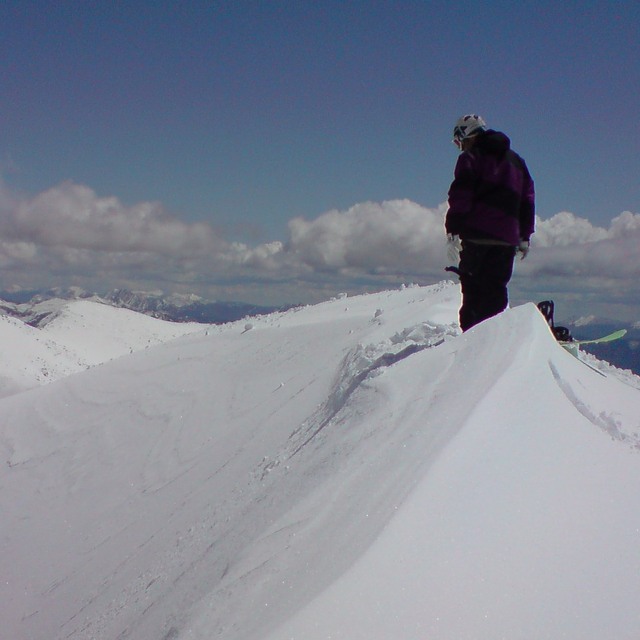
Photos of Fuentes de Invierno

Fuentes de Invierno by Abelardo Artidiello
toneu by cimer
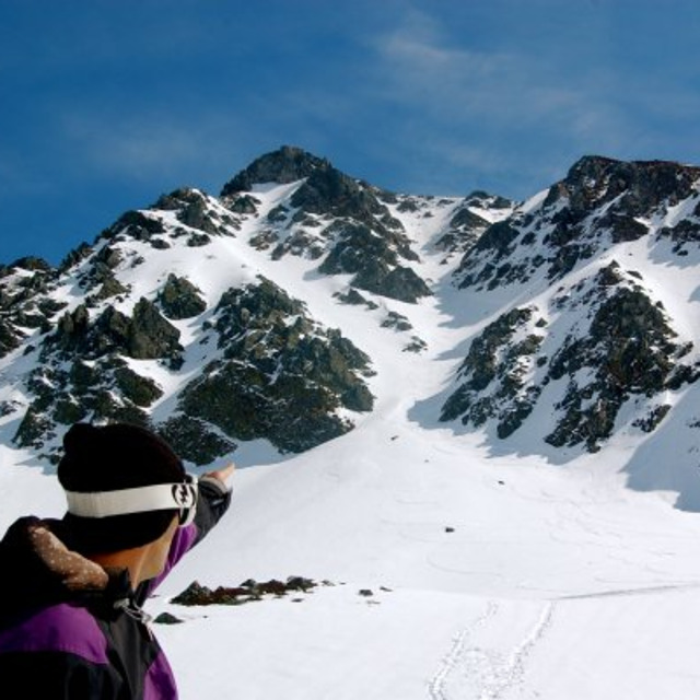
Toneu by cimer
Other resorts in Spain are reporting: powder (0) / good piste (0)
The above table gives the weather forecast for Fuentes de Invierno at the specific elevation of 1726 m. Our sophisticated weather models allow us to provide snow forecasts for the top, middle and bottom ski stations of Fuentes de Invierno. To access the weather forecasts for the other elevations, use the tab navigation above the table. For a wider view of the weather, check out the Weather Map of Spain.
Click here to read further information on freezing levels and how we forecast our temperatures.
Visitor Reviews of Fuentes de Invierno
Overall 3.4 Based on 21 votes and 3 reviews
- Snowsure
- Variety of pistes
- Vote
- Mark Cotgrove from Spain writes:
Although it is literally next door to San Isidro, the 2 areas couldn't be more different. San Isidro is a beginners mountain with nothing of interest for advanced skiers. Fuentes, however, is a seriously fun mountain for advanced skiers with tons of in-area and out of area off-piste and has some good steep pitches. Amazing amount of skiing for only a few lifts with some short climbing options to some great steep terrain. Not a holiday resort but absolutely worth a visit if you're an advanced skier. The conditions are good and you're in the region.
Visitor Reviews of Fuentes de Invierno
Mark Cotgrove from Spain writes:
Although it is literally next door to San Isidro, the 2 areas couldn't be more different. San Isidro is a beginners mountain with nothing of interest for advanced skiers. Fuentes, however, is a seriously fun mountain for advanced skiers with tons of in-area and out of area off-piste and has some good steep pitches. Amazing amount of skiing for only a few lifts with some short climbing options to some great steep terrain. Not a holiday resort but absolutely worth a visit if you're an advanced skier. The conditions are good and you're in the region.
Read 2 more reviews of Fuentes de Invierno or submit your own
Free Snow-Forecast.com weather widget for your website
The Fuentes de Invierno skiing weather widget is available to embed on external websites free of charge. It provides a daily summary of our Fuentes de Invierno snow forecast and current weather conditions. Simply go to the feed configuration page and follow the 3 simple steps to grab the custom html code snippet and paste it into your own site. You can choose the snow forecast elevation (summit, mid-mountain or bottom lift) and metric/imperial units for the snow forecast feed to suit your own website…. Click here to get the code.
View detailed snow forecast for Fuentes de Invierno at:
snow-forecast.com

 Nearest