


View forecast
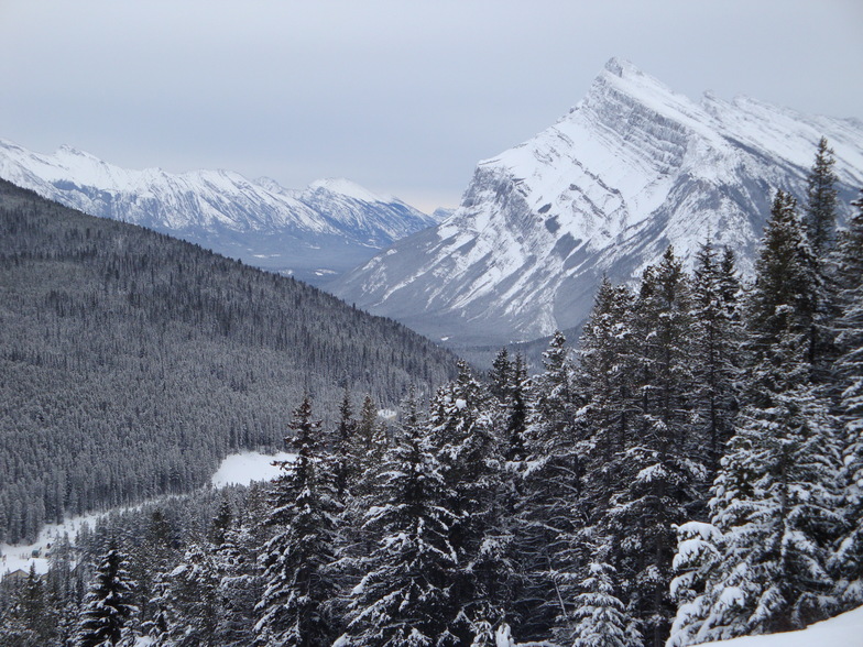
Banff Mt Norquay at 1790 m altitude
Issued by Snow-Forecast.com at: 11 pm (local time) / 19 May 2024
Now
Monday 20 | Tuesday 21 | Wednesday 22 | Thursday 23 | Friday 24 | Saturday 25 | ||||||||||||||
night | AM | PM | night | AM | PM | night | AM | PM | night | AM | PM | night | AM | PM | night | AM | PM | night | |
light snow | light snow | light rain | light snow | light rain | light rain | mod. rain | light snow | light rain | snow shwrs | some clouds | light rain | snow shwrs | cloudy | light rain | light snow | light snow | light rain | snow shwrs | |
km/h | |||||||||||||||||||
Snow map |  |  |  | 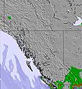 | 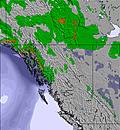 | 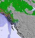 | 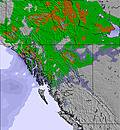 | ||||||||||||
1.0 | — | — | — | — | — | — | 1.0 | — | — | — | — | — | — | — | 5 | — | — | — | |
2.0 | 1.0 | 4 | 2.0 | 2.0 | 2.0 | 8 | 2.0 | 2.0 | — | — | 2.0 | 1.0 | — | 2.0 | 3 | 1.0 | 3 | 2.0 | |
max°C | 3 | 4 | 5 | 3 | 6 | 8 | 6 | 2 | 3 | 1 | 5 | 6 | 4 | 4 | 6 | 4 | 3 | 4 | 3 |
min°C | -1 | 2 | 5 | 1 | 4 | 8 | 3 | 2 | 2 | -2 | 2 | 6 | 1 | 3 | 5 | 0 | 1 | 4 | 0 |
-3 | 1 | 4 | 0 | 3 | 7 | 3 | 0 | 0 | -2 | 2 | 5 | -1 | 1 | 4 | -2 | -2 | 3 | -2 | |
91 | 78 | 66 | 97 | 78 | 53 | 96 | 99 | 78 | 93 | 67 | 60 | 88 | 78 | 65 | 98 | 82 | 78 | 91 | |
1800 | 2000 | 2350 | 2100 | 2250 | 2650 | 2400 | 2050 | 2200 | 1600 | 2000 | 2500 | 2050 | 2150 | 2450 | 2150 | 1900 | 2300 | 1900 | |
— | 5:43 | — | — | 5:41 | — | — | 5:41 | — | — | 5:39 | — | — | 5:39 | — | — | 5:37 | — | — | |
— | — | — | 9:34 | — | — | 9:35 | — | — | 9:37 | — | — | 9:37 | — | — | 9:38 | — | — | 9:40 | |
Next 0-3 days weather summary:
Heavy rain (total 25.0mm), heaviest during Tue night. Later becoming colder with a dusting of snow on Wed morning. Freeze-thaw conditions (max 8°C on Tue afternoon, min -1°C on Sun night). Wind will be generally light.
Next 4-6 days weather summary:
Mild with moderate rain (total 12.0mm) on Fri night, Becoming colder with a light covering of snow, mostly falling on Fri night. Freeze-thaw conditions (max 6°C on Thu afternoon, min -2°C on Wed night). Wind will be generally light.
Popular Banff Mt Norquay Pages
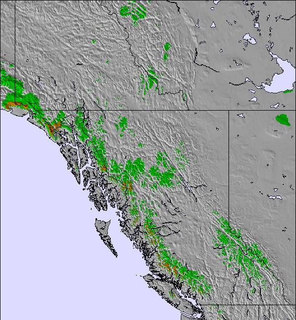
Snow Radar
Latest snow reports near Banff Mt Norquay:
Banff Mt Norquay Snow Conditions
| Top snow depth: | — |
|---|---|
| Bottom snow depth: | — |
| Fresh snowfall depth: | 14 cm |
| Last snowfall: | 17 May 2024 |
| Snow Alerts | Create Alert |
Other resorts in Canada - Alberta are reporting: powder (0) / good piste (1)
Snow-Forecast Partner Offers
Banff Paintings from The Ski Guru
Snow History
Week 3 of May has on average:
0.0 | Bluebird Powder days Fresh snow, mostly sunny, light wind. |
|---|---|
0.1 | Powder days Fresh snow, limited sun, any wind. |
0.0 | Bluebird days Average snow, mostly sunny, light wind. |
Banff Mt Norquay Forecast Snowfall


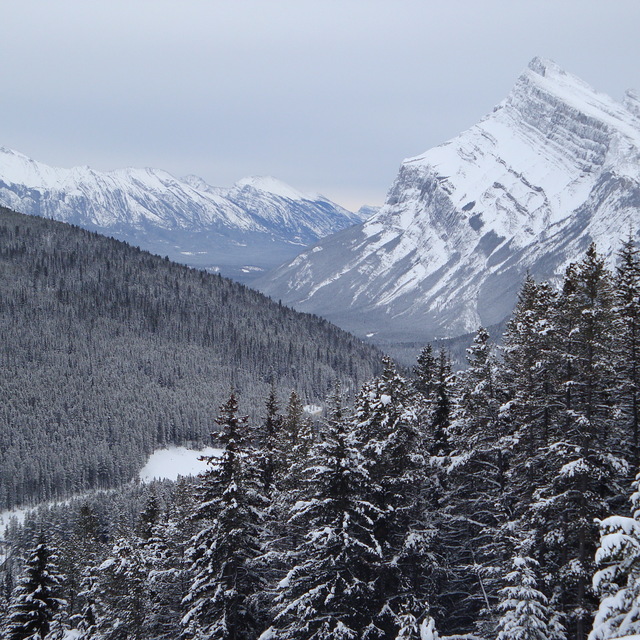
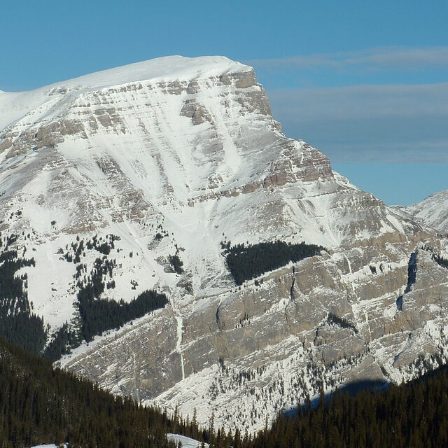
Photos of Banff Mt Norquay
Love this view! by martin paine
rockies! by andywells
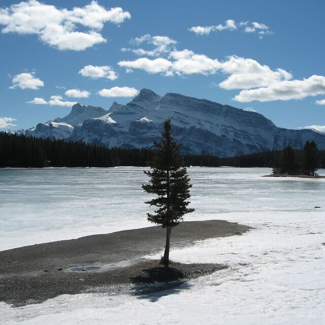
Frozen Lakeside in Banff by BeRo
Other resorts in Canada - Alberta are reporting: powder (0) / good piste (1)
The above table gives the weather forecast for Banff Mt Norquay at the specific elevation of 1790 m. Our sophisticated weather models allow us to provide snow forecasts for the top, middle and bottom ski stations of Banff Mt Norquay. To access the weather forecasts for the other elevations, use the tab navigation above the table. For a wider view of the weather, check out the Weather Map of Canada.
Click here to read further information on freezing levels and how we forecast our temperatures.
Resort name is also written as Banff Mount Norquay.
Visitor Reviews of Banff Mt Norquay
Overall 3.4 Based on 10 votes and 14 reviews
- Snowsure
- Variety of pistes
- Vote
- Steve from France writes:
I heard a lot about Norquay being smaller than Louise or Sunshine. It's true, but no line-ups (even at Xmas) and a crazy 'tubing' faster than anywhere I know! Super staff, super groomed slopes and still crazy chutes if you can walk 5 min. On north east storms this is the place to be! They receive tonnes of snow from the north east. The lines are steep and no flats like Sunshine... Only 5 min from Banff. You can just go there for 1 or 2 hours on lunch brake or for a bit of park practice. Don t miss it!
Visitor Reviews of Banff Mt Norquay
Steve from France writes:
I heard a lot about Norquay being smaller than Louise or Sunshine. It's true, but no line-ups (even at Xmas) and a crazy 'tubing' faster than anywhere I know!
Super staff, super groomed slopes and still crazy chutes if you can walk 5 min.
On north east storms this is the place to be! They receive tonnes of snow from the north east.
The lines are steep and no flats like Sunshine...
Only 5 min from Banff. You can just go there for 1 or 2 hours on lunch brake or for a bit of park practice.
Don t miss it!
Free Snow-Forecast.com weather widget for your website
The Banff Mt Norquay skiing weather widget is available to embed on external websites free of charge. It provides a daily summary of our Banff Mt Norquay snow forecast and current weather conditions. Simply go to the feed configuration page and follow the 3 simple steps to grab the custom html code snippet and paste it into your own site. You can choose the snow forecast elevation (summit, mid-mountain or bottom lift) and metric/imperial units for the snow forecast feed to suit your own website…. Click here to get the code.
View detailed snow forecast for Banff Mt Norquay at:
snow-forecast.com

 Nearest